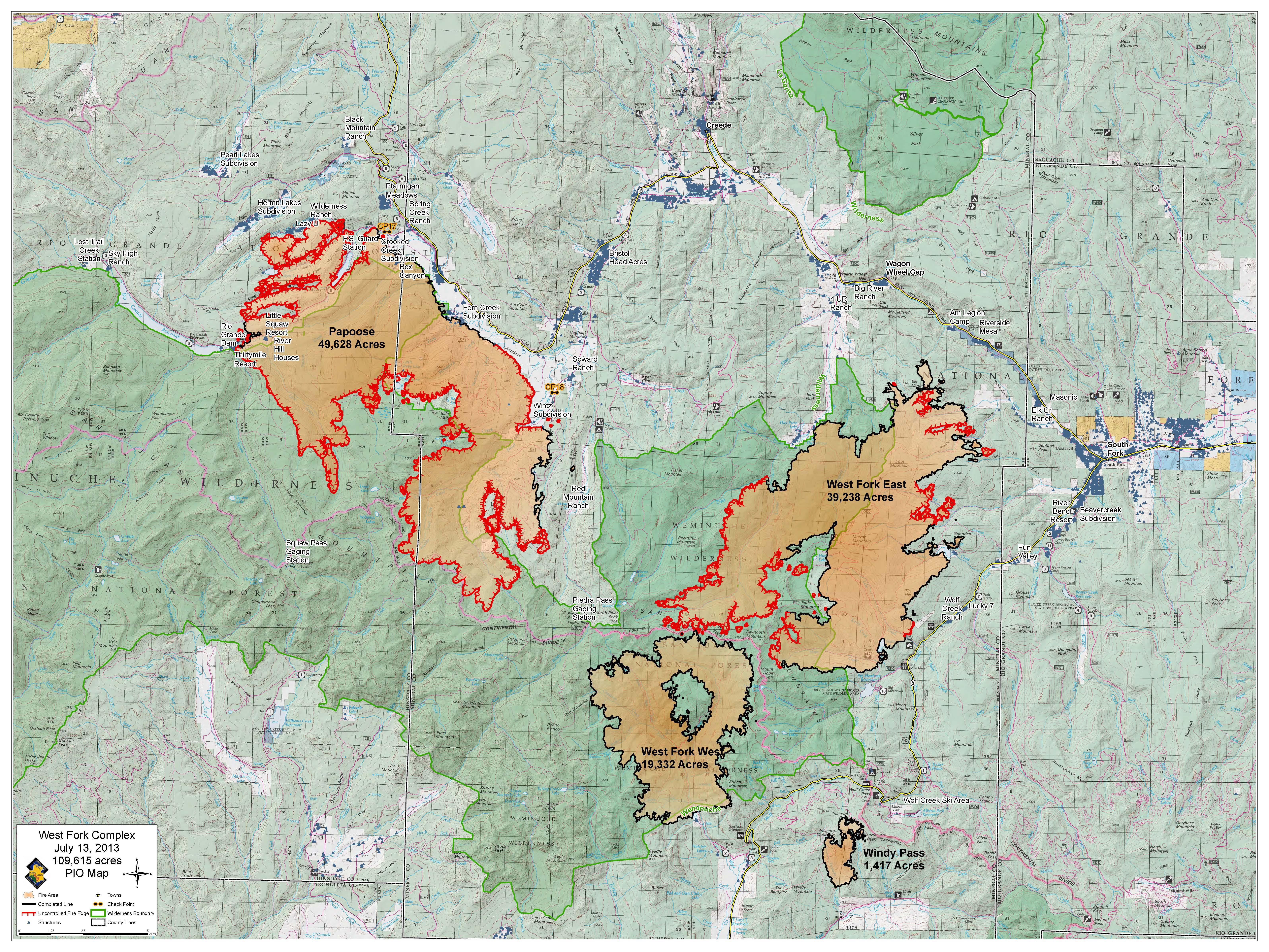
• Fire Map: West Fork
Complex
Note: This fire occurred in 2o13, the year following our first Pagosa
Springs Foray. Some of the areas we might have visited that year
were already severely affected by bark-beetle die-offs.
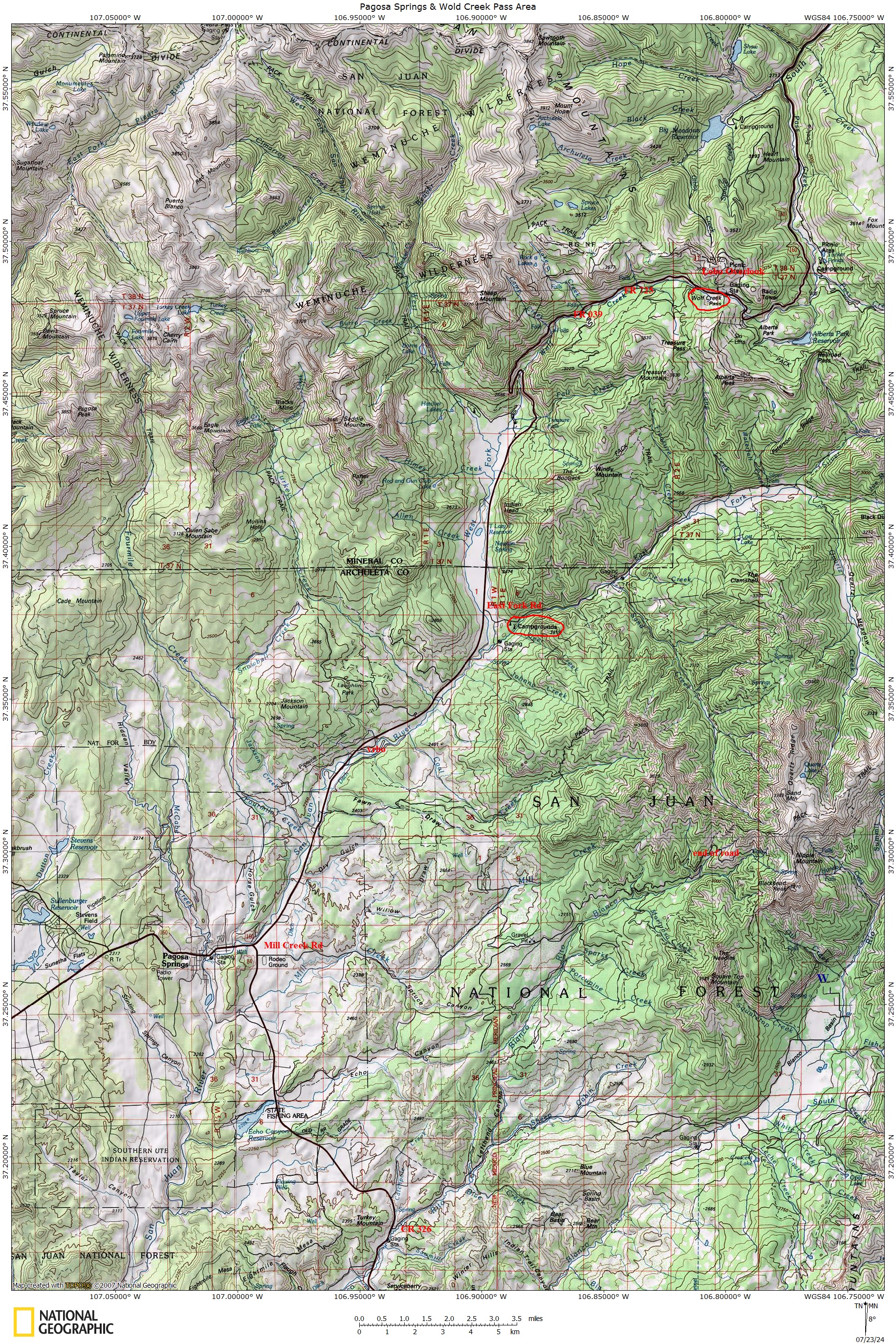
Pagosa Springs/Wolf Creek Pass Overview, a reference for participants
of NMMS' July 2o24 Archuleta County outing.
• jpeg
• pdf
2o12 (& 2o13) Field Trip Maps (2-3 mb PDF files)
• Williams Creek & Middle
Fork TH
• Fourmile TH
• Mill Creek Rd
• Mill Creek
Rd & Blanco Basin
• East Fork of San Juan
• Turkey Creek & Jackson
Mtn Rds
• Falls Creek & Wolf Creek
Rds
Note: These Maps were created prior
the 2o12 Foray and may not accurately reflect the ultimate field
trip locations for 2o12 & 2o13 Forays.
• The 2o12 & 2o13 Forays were operated under a
special use permit with the San Juan National Forest.
~~~~~~~~~~~~~~~~~~~~~~~~
MycoWest.net/forays/f4c~c/maps
dmw
.
2o24-o8-o2