Friday - All Day
1. Taos Ski Valley - All Day <> Moderate to Strenuous <> 44 mi
<> Map 2
T.27N. R.14E. S.4 <>
+36.59738-105.45093/9500 <>
459717,4050099,2900
Predominantly aspen forest with spruce on moderately steep slopes. There
are also open ski runs. Bull of the woods trail, which leads from the
parking lot, has many wildflowers.
2. Middle Fork of Red River - car <> Moderate <> 40
<> Map 2
T.28N. R.14E. S.35 <>
+36.61111-105.41290/9700 <>
463125,4051607,2946
This is an automobile trip. Last 1.3 miles are very rocky but passable by
passenger cars. The area is an unmanaged, and usually moist, spruce, fir,
and aspen forest with elderberry, gooseberry, honeysuckle, and Rocky
Mountain Juniper undergrowth. A stream flows down the relatively steep
valley.
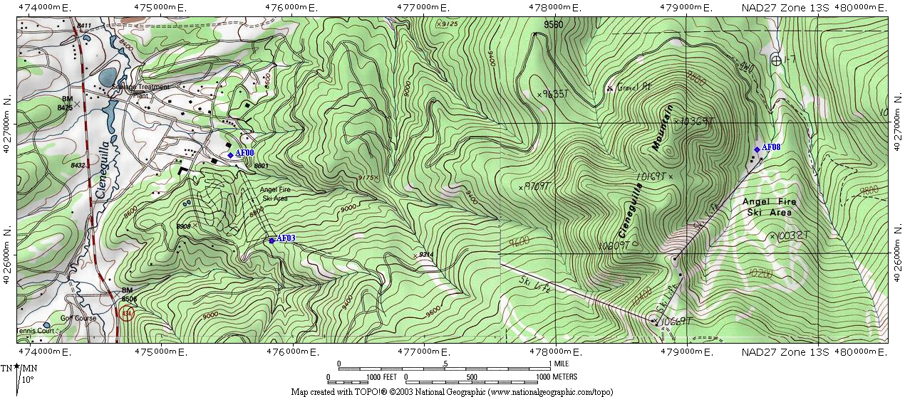
3A. Angel Fire Ski Lift; 10:00 to 3:00 <> Downhill <> 0 mi
<> +36.38164-105.26994/9000 <>
475839,4026108,2743
<> Map 3
Ride lower lift to top and walk down on open slopes or through forested
sides. You may also ride the lift down.
Friday Morning
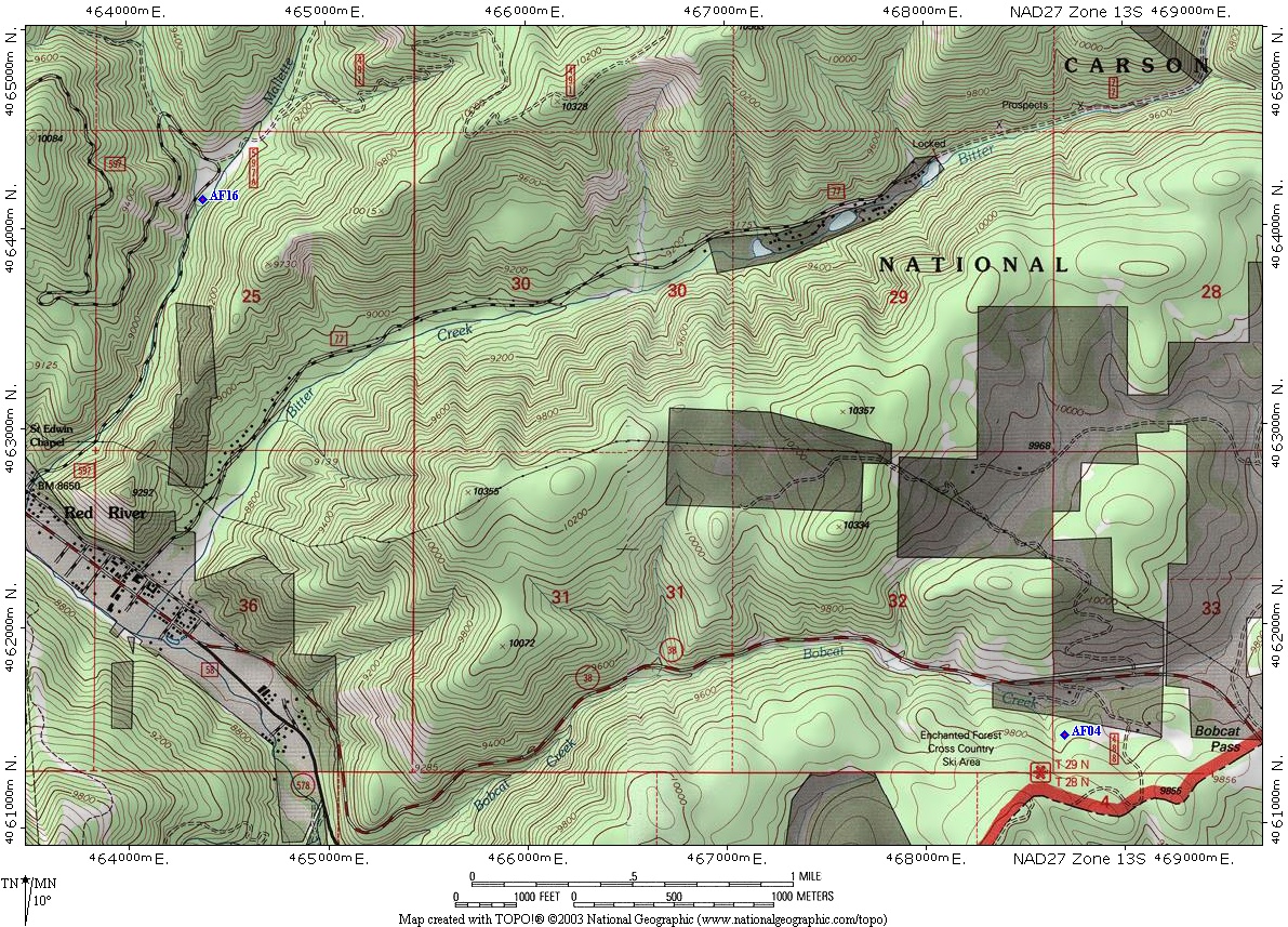
4. Enchanted Forest <> Easy to Moderate <> 26
<> Map 4
T.29N. R.15E. S.33 <>
36.69997,-105.35102,9700 <>
468695,4061442,2970
This is a cross country ski area with many trails for easy walking and old
growth, as defined by the forest service, spruce and aspen. Some down timber
and undergrowth which includes shrubby cinquefoil, Rocky Mountain Juniper,
mosses, and columbine.
5. Garcia Park - 8:00 AM <> Easy <> 22
<> Map 5
T.24N. R.14E. S12 <>
+36.33022-105.39910/10000 <>
464231,4020445,3014
A large open park area with isolated stands of, and surrounded by, aspen and
spruce. The last 7 miles are on a good forest service road.
Friday Afternoon
6. Palisades <> Easy <> 23
<> Map 6
T.27N. R.15E. <>
+36.53814-105.15468/7700 <>
486204,4043445,2348
The Cimarron River follows the road down the valley with steep slopes on one
side and the rock Palisades on the other. Moderately wide flat area along
the river has ponderosa, white fir, juniper, oak, and cottonwood, with
ground cover of spirea, Clematis liguisticifolia, choke cherry, and
scrub willow.
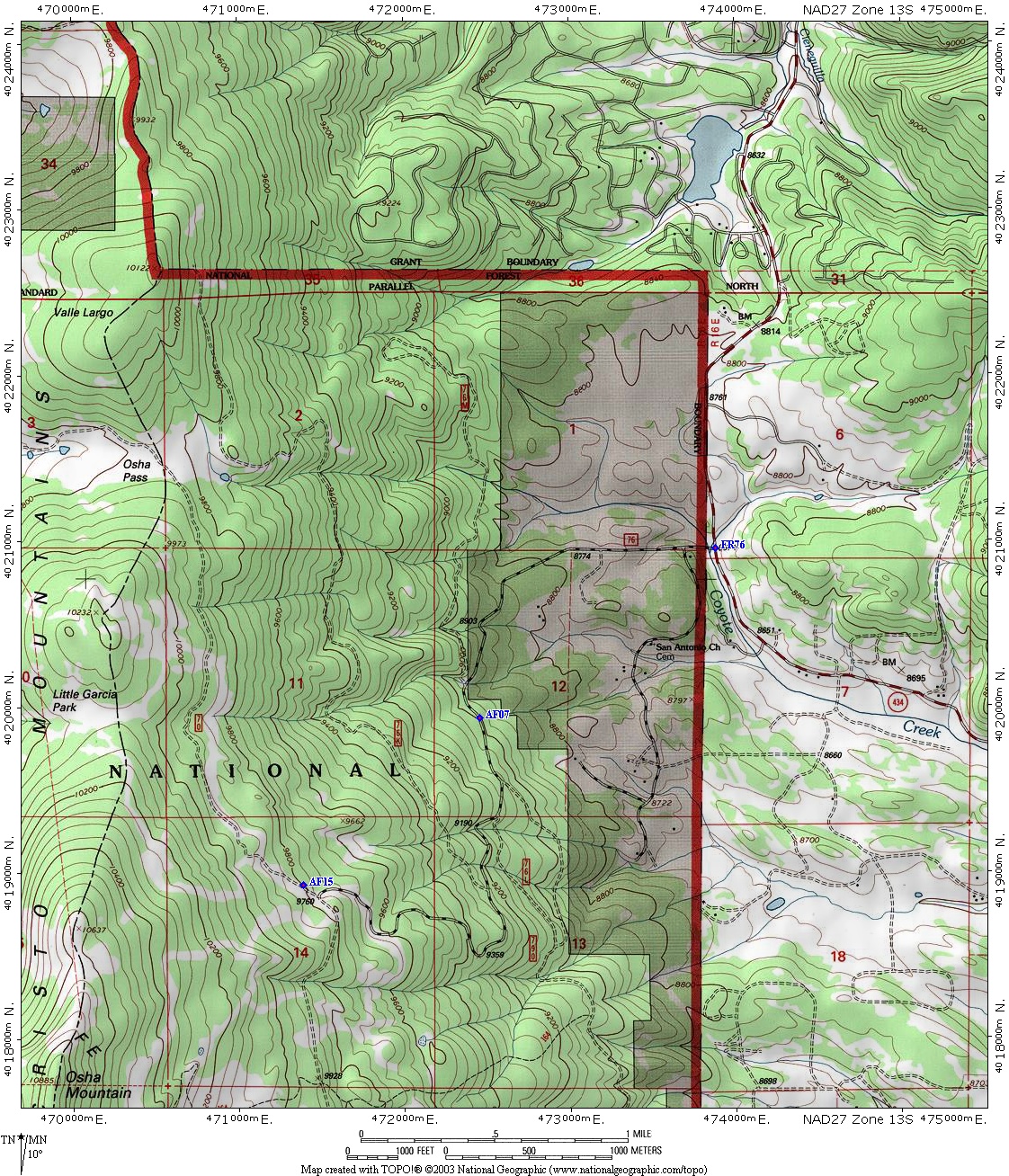
7. Forest Road 76, #1 <> Moderate to Strenuous <> 7
<> Map 7
T.24N. R.15E. S.12 <>
+36.32582-105.30747/9000 <>
472453,4019927,2743
Upper Canadian zone of mixed conifers including spruce, fir, narrow leaf
cottonwood, a few ponderosa, and many aspen with lower growing box elder,
snowberry, and alder. Some logging has taken place in the area.
8. Angel Fire Back Basin <> Moderate to Strenuous <> 6
<> Map 3
T.25N. R.16E. <>
+36.38789-105.22878/9300 <>
479532,4026792,2912
Open grass-covered ski run and steep slopes with Douglas and other fir,
spruce, and aspen. Considerable down timber and undergrowth, including low
Rocky Mountain Juniper.
Saturday - All Day
3B. Angel Fire Ski Lift; 10:00 to 3:00 <> Downhill <> 0 mi
<> +36.38164-105.26994/9000 <>
475839,4026108,2743
<> Map 3
Ride lower lift to top and walk down on open slopes or through forested
sides. You may also ride the lift down.
Saturday Morning
10. Children's Foray. This trip is designed for children and will foray in a
nearby area. All children must be accompanied by adults. Please see Bruce
Trigg for Details and lunch plans.
Meet in the lobby of the Legends Hotel where the walk will begin.
T.25N. R.15E. S.10 <>
+36.41477-105.33551/9100 <>
469970,4029802,2777
South side of highway has primarily fir and aspen, with some open meadow
areas, mainly on hillsides. The north side is divided with a north-south
fence. The east side of this fence is private land while the west side is
Forest Service.
13. Upper Rio Fernando de Taos <> Easy to Moderate <> 9
<> Map 8
T.25N. R.15E. S.15&16<>
+36.40348-105.34604/8700 <>
469022,4028553,2662
Open meadow with mixed conifer (fir, spruce, and ponderosa) and aspen
within short walk.
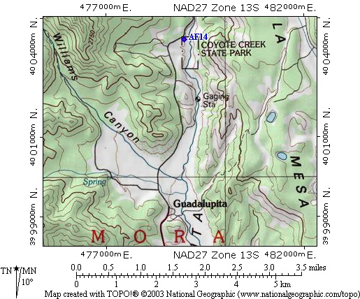
14. Coyote Creek State Park <> Easy to Moderate <> 19
<> Map 10
T.23N. R.16E. <>
36.17758,-105.23427,7600 <>
478983,4003466,2352
Scrub oak and ponderosa on the hillsides with bush willow along the stream
and in the open meadow. Meadow is easy walking while the hillsides are
fairly steep.
15. Forest Road 76, #2 <> Moderate to Strenuous <> 8
<> Map 7
T.24N. R.15E. S.14 <>
+36.31673-105.31932/9800 <>
471386,4018922,2987
Similar to Trip #7 but almost 1000 ft higher.
Saturday Afternoon
16. Mallette Creek <> Easy <> 33
<> Map 4
T.29N. R.14E. S.25 <>
+36.72421-105.39947/8900 <>
464378,4064148,2711
Valley with very small stream, open areas, and hillsides. Forest growth is
aspen, spruce, alder, and elderberry. Other vegetation includes honeysuckle,
lupine, paintbrush, flax, monkshood, and oenotheria.
17. Tolby Creek <> Easy to Moderate <> 17
<> Map 6
T.27N. R.16E. <>
+36.53740-105.22511/7900 <>
479900,4043376,2452
Riparian area with narrow leaf cottonwood, fir, and box elder. Low cover
includes cow parsnips, wild rose, and rock spray spirea. Moderately narrow
valley bottom is easy walking while valley sides are rather steep.
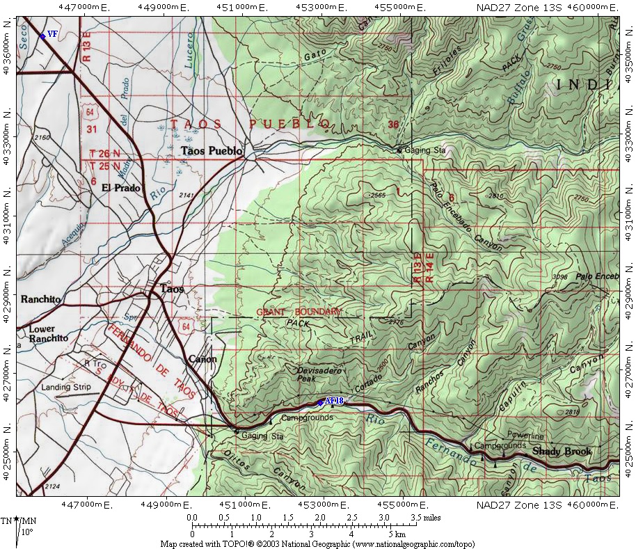
18. Lower Rio Fernando de Taos <> Moderate <> 21
<> Map 11,
Map 12
T.25N. R.13E. S.23 <>
+36.38159-105.52554/7300 <>
452913,4026197,2239
A short climb steep climb (25') on the south side of the river takes one
into pińon/juniper with some ponderosa, scrub oak, mountain mahogany, spruce
and fir. The slope on the north side has scattered pińon/juniper.